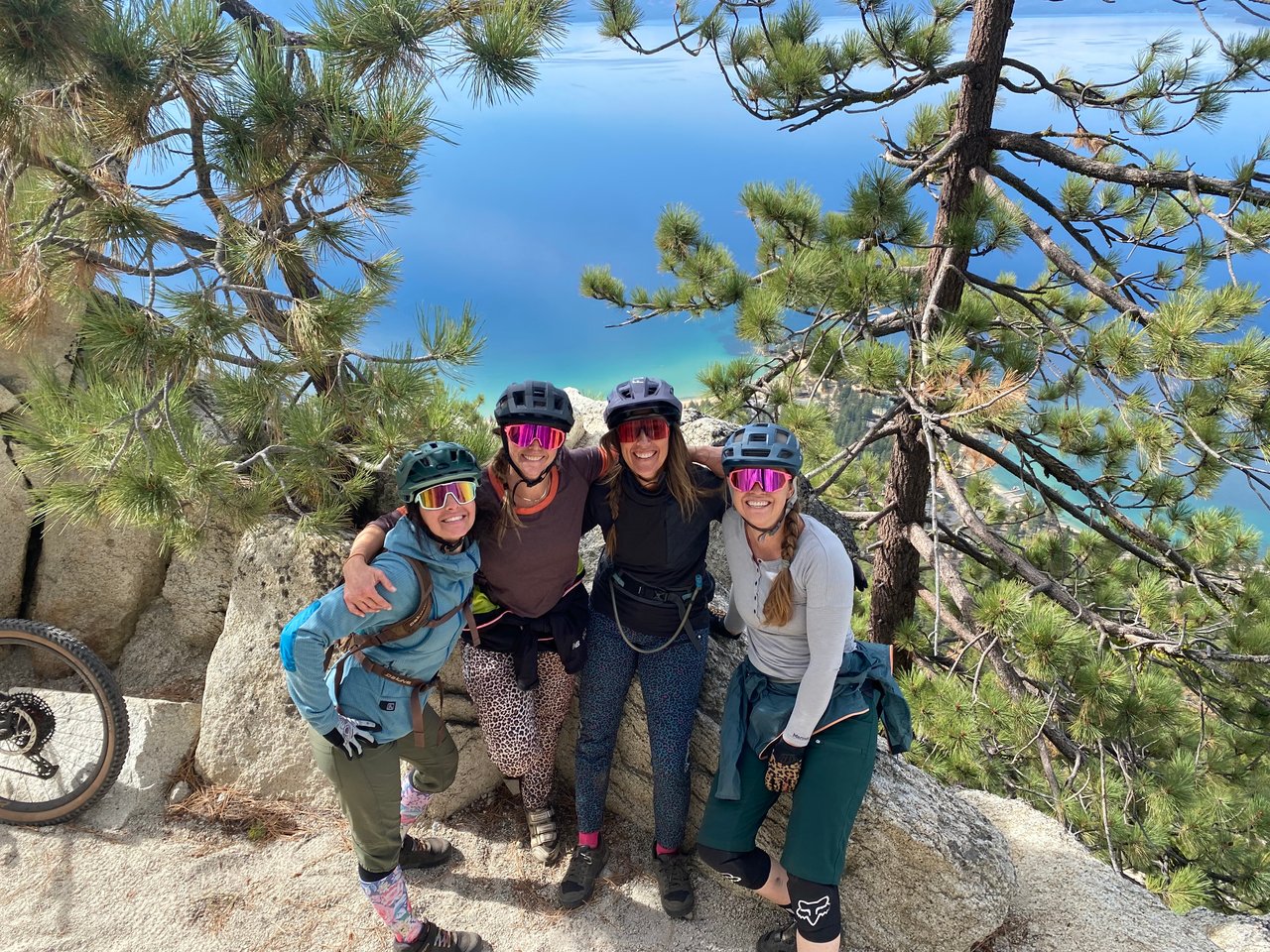
Best Spring Mountain Biking in Lake Tahoe and Truckee

When it comes to mountain biking, Lake Tahoe and Truckee boast some of the most thrilling trails in the country. From technical challenges to breathtaking scenery, there's something for every rider to enjoy. Here, we present some of the finest mountain biking trails in Lake Tahoe and Truckee that are ideal for early-season rides and situated at lower elevations

Waddle Ranch Preserve 🟢 - Truckee
Waddle Ranch Preserve offers easy and intermediate biking trails, making it ideal for families. To access the preserve, take Martis Dam Road from State Route 267 in Martis Valley, then follow the signs. With four trails to choose from, visitors can explore a variety of landscapes and difficulty levels.
-
Lake Ella via Matt's Trail and Sawmill Road
There's a 9.7-km loop trail near Kings Beach, California. It takes around 2.5 hours to complete and is moderately challenging. Dogs are allowed but must be leashed. The trail starts with a paved road across Martis Dam, then becomes dirt as it goes around Martis Lake. Take Matt's Trail uphill, turn left on Sawmill Road, and rest at Lake Ella's picnic table. Return via Erika's Trail for a moderate landscape experience and volcanic rock viewpoint before going downhill on Matt's Trail.
-
Martis Reservoir Dam via Matt's Trail
Explore the 3.5-km trail near Truckee, CA for birdwatching, skiing, and hiking. Accessible year-round, dogs are welcome on a leash. Consider a bike ride to Martis Creek Dam for bald eagle and osprey sightings.
-
Lake Ella and Martis Creek Lake Loop via Matt's Trail and Sawmill Road
Near Truckee, CA, take on the 11.7-km loop trail at Waddel Ranch Preserve. It takes roughly 2 hours and 54 minutes to complete and is best for birdwatching, cross-country skiing, and hiking. You'll see Martis Creek Dam and Lake Ella and may spot mule deer, bobcats, black bears, and coyotes. Remember to leash your dog if you bring them along.
-
Lake Ella via Royal Flush, Meagan's Trail, Katy's Walk, and Matt's Trail
Explore the 11.3-km loop trail near Truckee, CA for skiing, hiking, and biking. It takes about 2 hours and 48 minutes to complete. Open year-round and dog-friendly, the trail offers a peaceful atmosphere away from the crowds, guiding you through Meagan's, Katy's, and Matt's trails for a rewarding outdoor experience.

Sawtooth Trail System 🟢 🟦 - Truckee
This trail system is a more forested cross-country style ride with some more consistent elevations gains and losses giving you some fun descents depending on your route choice. The official Sawtooth trail starts on the right side of the Sawtooth Trailhead parking lot and offers two overlooks of Truckee River Canyon and and is fairly rocky/technical for beginner riders though offers a very attainable challenge. After a quick intersection with the US Forest Service Rd, the “06”, continue on the Sawtooth Trail which eventually loops back around in a lollipop or veer off to connect with Wood Splitter and Happy Face for some more advanced downhill flow style riding. Popular for day hikes, trail runs, and mountain biking, keep your eyes peeled for other trail users. Sawtooth Trail Loop Info

Emigrant Trail 🟢 🟦 - Truckee
This trail is an out-and-back from Donner Picnic Area off 89 North to Stampede Reservoir. In the early season parking at the Hobart Mills trailhead might be a better option as the forest between Prosser and Hobart Mills tends to hold some north facing pockets of snow a bit longer. Expect rolling single-track that is more cross-country style riding with some ups followed by some downs. Generally on the way out to Stampede there is more elevation gain than loss making the way back more downhill. With the whole trail being around 18 miles, there are several top-outs along the way that are great turn-around points allowing you tailor the ride to any distance/time that you want!
With some minorly technical sections and some ascents that are a little steeper but not too long, this trail is suitable for the advanced beginner to intermediate rider. The cross-country style of the ride and lack of absolutely crushing uphill right from right from the get-go makes this trail more accessible for a wide range of riders. Commemorative Emigrant Trail Info

Tahoe Mountain Trail to Valley View 🟦-South Lake Tahoe
Check out this beautiful ride on the east side of Fallen Leaf lake offering a gradual climb and fun downhill. Situated at a slightly higher elevation than some other rides in this post, you may have to wait a little longer for the snow to melt out here. Ranked an intermediate trail, you can expect single-track riding with some slightly steeper sections, switchbacks and some fun features to play on. And views galore! You’ll ride through beautiful forests and scenic vistas of both Lake Tahoe and Fallen Leaf Lake! Breathtaking.
The best way to ride this trail is to park at Angora Ridge/Valley View parking. You can either ride this as an out-and-back or make it into a loop and connect with the Valley View Trail for the descent. The climb in this direction starts gradual and transitions into some steeper switch backs gaining about 600 ft in elevation to the Devron Connector intersection that will bring you to Valley View. If you want some more climbing continue on the Tahoe Mountain Trail for another .25 miles to the next intersection that will bring you to the Upper Valley View section. A more challenging section, this will drop you to Valley View where your descent continues with fun switch backs and a more gradual downhill. Depending on which route you choose, this ride is between 4.5-5 miles and should take 1-1.5 hrs. Tahoe Mountain Trail-Valley View Connector Trail Info

Railroad Grade Loop 🟢 - South Lake Tahoe
This excellent introductory single-track and double-track loop is just shy of 5 miles and lies at low-elevation which melts out early. Start by parking at the split-rails on Pioneer Trail to access the loop which begins on the Pioneer Trail Extension. This double-track offers a few rollers, very little change in elevation, and lacks any obstacles requiring any technical skills. From there connect with the Railroad Grade Trail which starts on an old railroad bed and veers off into the trees and rolls through some fun and easy corners. This all-levels friendly trail is a great intro to mountain biking or a great early season warm-up for advanced riders. Railroad Loop Trail Info
Tips : Rated easy, this single and double track is fun for the whole family and a great way to get your biking legs warmed up for the season.

Your MTB aficionado and local real estate advisor, Christy Deysher expert behind the seat
Donkey Town 🟦 -Truckee
Donkey Town, formerly known as "Jackass", offers an intermediate to advanced mountain biking experience filled with SO MANY fun features which has earned this trail it's claim to fame. A true progression bike-park style flow trail, it is suitable for most skill levels. With most challenging features having an alternative way around, riders should be aware and ready to pivot if necessary. You can expect well maintained, swooping banked corners, rock rides, and jumps ranging from beginner low-consequence drops to intermediate gaps. With this being a quick loop at around 4 miles and with an elevation gain of 500 ft you can see why it has become a local go-to for the pre- or post-work ride. Get your cake and eat it too!
Start this ride by parking just south of the stop light at the Rt 89 and West River St intersection where there is ample parking on the west side. A majority of the climb is up a fire road. Continue following the road straight when you see the bridge going off to the left. At the top of the road you will arrive at a clearing and a single-track intersection. Hang right on the single-track to ride Donkey Town. You'll have a little bit of climbing before coming to the top with some peak views of Donner. Continue on from there for the epic descent! Donkey Town Trail Info
Directions: Follow these directions to begin your Donkey Town adventure.

Beaver Tail to Rise and Shine 🟢 🟦 - Kings Beach Trail Network
Kings Beach offers a smaller system of trails and variations of Beaver Tail Trail, including the Beaver Tail to Rise and Shine loop, are typically the first to be clear of snow in the Kings Beach area. The trail is a smooth single-track that can be extended for a longer hike or bike ride by following the Rim Trail. There are no water sources along the trail, but shaded areas provide some relief from the sun.
Park either at the end of Beaver St or Chipmunk and hop a connector trail that will bring you up to Beaver Tail. Head Northeast (right) on Beaver Tail for your climb that is mostly gradual with some steep switch-backs. You’ll reach the top of your climb at around 2.3 miles and bear left at a minor trail intersection. In around .2 miles you’ll turn left (south) onto Rise and Shine for a fun flowy downhill. This intermediate trail offers some technical terrain and some challenging ascents that are short and walkable for the less advanced rider. With some easier flow trail features this is a great trail for someone who wants to progress their flow trail skills.

Tahoe City XC Center 🟢 🟦- Tahoe City
The Tahoe Nordic Center is a well-known cross-country ski center during the winter season that transforms into a mountain biking paradise in the summer. The area offers a wide variety of trails and fire roads that cater to riders of all levels. Tahoe City is a great destination for riders, whether they are beginners or looking for a leisurely-paced ride. With an extensive trail network, there is something for everyone. From easy loops for beginners to more challenging and extensive rides, the trails offer plenty of opportunities for exploration. Whether you prefer a quick out-and-back trip or a scenic point-to-point adventure, Tahoe City has got you covered. Later in the summer as the snow recedes you can increase the length and difficulty of your ride by hooking up with the Tahoe Rim Trail and biking to either Painted Rock or Watson Lake. Tahoe City XC Center Info

Tahoe Pyramid Bikeway- 🟢 Truckee - Verdi
The journey starts from the center of Truckee and continues as a smooth and paved route that leads you all the way to the Glenshire area. Once you arrive at Glenshire Blvd, the path becomes uneven and challenging, but it eventually takes you to Verdi, where you will find remains of the old Hwy 40 and unpaved service roads. Tahoe Pyramid Bikeway
Tip: I suggest that you explore this trail during the late spring or autumn seasons, using a gravel bike with 40mm tubeless tires or a mountain bike
Tahoe Mountain Trail to Valley View 🟦 - South Lake Tahoe
Check out this beautiful ride on the east side of Fallen Leaf lake offering a gradual climb and fun downhill. Situated at a slightly higher elevation than some other rides in this post, you may have to wait a little longer for the snow to melt out here. Ranked an intermediate trail, you can expect single-track riding with some slightly steeper sections, switchbacks and some fun features to play on. And views galore! You’ll ride through beautiful forests and scenic vistas of both Lake Tahoe and Fallen Leaf Lake! Breathtaking.
The best way to ride this trail is to park at Angora Ridge/Valley View parking. You can either ride this as an out-and-back or make it into a loop and connect with the Valley View Trail for the descent. The climb in this direction starts gradual and transitions into some steeper switch backs gaining about 600 ft in elevation to the Devron Connector intersection that will bring you to Valley View. If you want some more climbing continue on the Tahoe Mountain Trail for another .25 miles to the next intersection that will bring you to the Upper Valley View section. A more challenging section, this will drop you to Valley View where your descent continues with fun switch backs and a more gradual downhill. Depending on which route you choose, this ride is between 4.5-5 miles and should take 1-1.5 hrs. Tahoe Mountain Trail-Valley View Connector Trail Info
Railroad Grade Loop 🟢 - South Lake Tahoe
This excellent introductory single-track and double-track loop is just shy of 5 miles and lies at low-elevation which melts out early. Start by parking at the split-rails on Pioneer Trail to access the loop which begins on the Pioneer Trail Extension. This double-track offers a few rollers, very little change in elevation, and lacks any obstacles requiring any technical skills. From there connect with the Railroad Grade Trail which starts on an old railroad bed and veers off into the trees and rolls through some fun and easy corners. This all-levels friendly trail is a great intro to mountain biking or a great early season warm-up for advanced riders. Railroad Loop Trail Info
Tips : Rated easy, this single and double track is fun for the whole family and a great way to get your biking legs warmed up for the season.